Kanakapura Road
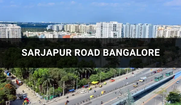
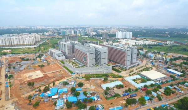
Kanakapura Road is one of south Bengaluru's most-watched residential corridors in 2026. The road runs southward as a major arterial designated National Highway NH-948. The Namma Metro Green Line is operational along the corridor, with stations such as Doddakallasandra, Konanakunte Cross and Yelachenahalli serving the residential belt. NICE Road (3 km) connects onward to Electronic City and Mysore Road. Big anchors include Forum South Mall (Kanakapura Road, 2 km), DMart and the green expanse of Turahalli Forest (5 km). National developers like Vaishnavi Group and Sobha are active here. Kanakapura Road has become south Bengaluru's structural growth corridor. Premium launches like Vaishnavi Vistara at Doddakallasandra now define its identity.
Kanakapura Road — Quick Corridor Facts
Kanakapura Road begins near Basavangudi in central south Bangalore. It extends 52–55 km southward. The route passes through Basavangudi, Banashankari, Jayanagar, Konanakunte, Doddakallasandra and Kaggalipura. It ends at the Tamil Nadu border en route to Dindigul. The road is officially National Highway NH-948 (formerly NH-948). It connects Bengaluru to Dindigul in Tamil Nadu (430 km).
The corridor is unusually well-resourced for a south-Bengaluru arterial. Inner and mid stretches get reliable Cauvery water. The wider area also has strong groundwater levels. The road meets the NICE Road just south of Konanakunte and connects to the Outer Ring Road at Silk Board. That gives residents quick access to Electronic City, JP Nagar and Mysore Road — without touching central-city traffic.
Kanakapura Road at a Glance — Key Facts (2026)
| Attribute | Detail |
| Length | 52–55 km (Basavangudi to Doddakallasandra town) |
| National Highway | NH-948 |
| Onward Route | Bengaluru → Doddakallasandra → Dindigul (Tamil Nadu) |
| Earlier Name | Kankanhalli Road |
| Metro Line | Namma Metro Green Line (Nagasandra ↔ Silk Institute) |
| Corridor Metro Stations | Banashankari, JP Nagar, Yelachenahalli, Konanakunte Cross, Doddakallasandra, Vajarahalli, Thalaghattapura, Silk Institute |
| Inner-entry Metro Stations | Banashankari, Jayanagar Hospital, Yelachenahalli |
| Key Intersections | NICE Road junction, Konanakunte Cross, Silk Board ORR |
| Water Supply | Cauvery (inner / mid stretches) + strong groundwater |
| Major Landmarks | Forum South Mall (2 km), DMart Kanakapura Road (1.5 km), Cloudnine Hospital (3 km), Turahalli Forest (5 km), Doddakallasandra Metro Station (0.5 km) |
| Top Educational Anchors | Suryodaya International School, Sri Kumaran Children's Home, Dayananda Sagar College (Kumaraswamy Layout) |
| Avg. residential rate (2026) | ₹9,000–₹16,500 / sq.ft. (varies by sub-locality) |
| 5-year corridor appreciation | 50–70% cumulative |
| Notable luxury launch | Vaishnavi Vistara — Doddakallasandra, pre-launch rate ₹13,500 / sq.ft. |
Overview of Kanakapura Road's Real Estate Transformation
A few decades ago, Kanakapura Road was a peripheral, shrub-lined "cutcha" (unpaved) arterial — a rural route where buses and bullock carts had to wade across the Arkavathi River. Things look very different now.
The transformation played out in three phases. First, the road was upgraded from Kankanhalli Road into a divided highway. It was renamed National Highway NH-948 (earlier NH-948). Then, in the late 2010s and early 2020s, the Namma Metro Green Line extension arrived. The southern corridor stations came online — Banashankari, JP Nagar, Yelachenahalli, Konanakunte Cross and Doddakallasandra — extending the Green Line down Kanakapura Road to Silk Institute, the southern terminal. Finally, the social infrastructure layer arrived. Forum South Mall and DMart opened along Kanakapura Road. Cloudnine Hospital and other healthcare anchors followed, while the green expanse of Turahalli Forest gave the corridor a natural recreation draw. Education campuses including Dayananda Sagar College at nearby Kumaraswamy Layout serve the neighborhood too. Together, these shifts repositioned Kanakapura Road. It went from a distant suburb route to one of Bengaluru's most desirable residential corridors.
How Kanakapura Road Became South Bengaluru's Premium Belt
Land in Jayanagar and HSR Layout dried up. Prices ran ahead of practical end-user budgets. The southbound upgrade buyer moved along Kanakapura Road. The corridor offered four strong advantages — metro walkability, NICE Road access to Electronic City and Mysore Road, Cauvery water on inner stretches, and clean-air sub-localities like Doddakallasandra–Konanakunte Cross. National developers followed. Vaishnavi Group set up at Doddakallasandra. Sobha launched across multiple sub-localities. Each brought premium product to the neighborhood.
The Metro Inflection Point
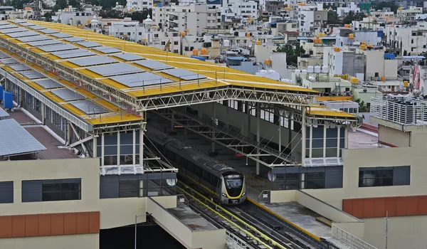
The Namma Metro Green Line was the single biggest catalyst. Before the extension, Kanakapura Road was a road-only arterial. It was well-located on paper but commute-limited in practice. Now Banashankari, JP Nagar, Yelachenahalli, Konanakunte Cross, Doddakallasandra and Vajarahalli are all operational. Residents get rapid, traffic-free access to Majestic and the CBD via the Green Line, with an interchange to the Purple Line, and to R.V. Road where the Yellow Line branches toward Electronic City. The metro reset the corridor's value perception. It also unlocked the developer interest that has shaped its 2026 identity.
Namma Metro Green Line on Kanakapura Road
Kanakapura Road is the only major south-Bengaluru corridor with a fully operational metro in 2026. The metro covers the full residential length of the road. The Namma Metro Green Line runs from Nagasandra in the north to Silk Institute in the south. The southern stretch covers Kanakapura Road. Five stations serve the primary residential belt directly:
- Yelachenahalli — Inner-corridor station (approx. 2 km) with high pedestrian and BMTC connectivity into the city core
- Konanakunte Cross — Mid-corridor residential anchor (approx. 1.5 km); serves the Doddakallasandra residential belt
- Doddakallasandra — Closest station (approx. 0.5 km); anchor for the Doddakallasandra belt; serves Vaishnavi Vistara and adjacent low-density launches
- Vajarahalli — Adjacent station southward serving the growing residential pocket
- Thalaghattapura / Silk Institute — Southern stations extending the Green Line down the corridor
Inner-end stations Banashankari, Jayanagar Hospital and Yelachenahalli serve the northern end of the corridor where Kanakapura Road meets the urban core. From any of these stations, commuters can interchange to the Purple Line at Nadaprabhu Kempegowda Station (Majestic). That covers east-west travel. They can also switch to the Pink Line at Jayadeva Hospital (U/C). That covers central Bangalore and onward to north Bengaluru via Majestic interchange.
What Kanakapura Road Is Famous For
Kanakapura Road is famous for more than residential real estate. It combines clean air, green open spaces, premium retail, healthcare and education campuses. Few south-Bengaluru corridors match this mix.
Nature & Retreats
- Turahalli Forest — A green lung off Kanakapura Road (approx. 5 km via Vajarahalli Road), popular for morning walks, cycling and weekend nature outings
- Doddakallasandra green pockets — Tree-lined residential lanes and open spaces give the Doddakallasandra belt a calmer, low-density feel close to Turahalli Forest
- DMart, Kanakapura Road — Everyday hypermarket retail close to the corridor (approx. 1.5 km)
- Forum South Mall — Anchor lifestyle and retail destination on Kanakapura Road (approx. 2 km)
Education
- Suryodaya International School — Established K-12 school close to the Doddakallasandra belt (approx. 1.5 km)
- Sri Kumaran Children's Home — Well-known school serving the corridor (approx. 2 km)
- Dayananda Sagar College — Engineering and applied-sciences campus at nearby Kumaraswamy Layout (approx. 5 km)
- Reputed K-12 schools & colleges — The Doddakallasandra–Konanakunte belt is served by a cluster of established schools and colleges, with easy metro and road access to wider South Bangalore campuses
Retail, Healthcare & Leisure
- Forum South Mall / Forum Falcon City — Anchor malls on Kanakapura Road (approx. 2 km) with multiplex, F&B and lifestyle retail
- Sagar Hospitals, Kumaraswamy Layout — Multi-speciality top-tier-care hospital near the corridor (approx. 5 km)
- Cloudnine Hospital, Kanakapura Road — Maternity and women's health speciality hospital (approx. 3 km)
- DMart, Kanakapura Road — Hypermarket and everyday retail along the corridor (approx. 1.5 km)
- Kanakapura Road dining belt — A growing cluster of restaurants, cafes and casual-dining outlets along the corridor
Established and Emerging Residential Belts on Kanakapura Road
The corridor's residential belt covers a wide pricing and product spectrum, anchored by these sub-localities (north to south):
- Banashankari & Jayanagar (inner corridor) — Mature residential cores, primarily resale inventory
- Konanakunte & Doddakallasandra — Mid-corridor mid-segment to premium launches; Forum Mall anchor
- Doddakallasandra — Low-density luxury belt; home to Vaishnavi Vistara and the broader Doddakallasandra–Konanakunte Cross premium neighborhood
- Doddakallasandra & Kaggalipura — Newer residential corridor with mid-to-well-appointed inventory and onward villa belts
- Doddakallasandra Town — Southern terminus with predominantly plotted and villa-format developments
Vaishnavi Vistara on Kanakapura Road
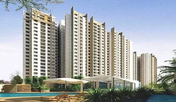
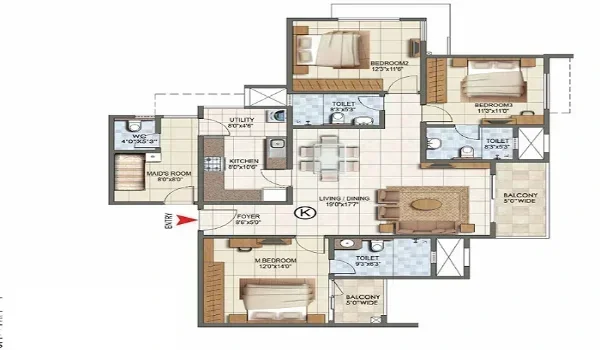
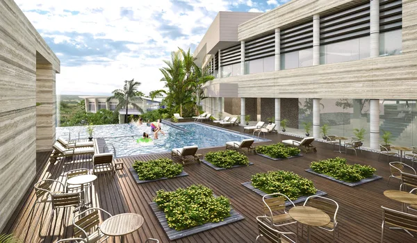
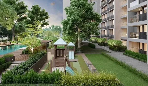
Vaishnavi Vistara is Vaishnavi Group's low-density luxury launch along Kanakapura Road at Doddakallasandra (PIN 560062). Configurations are 1, 2 and 3 BHK, with carpet areas of approx. 680, 1280 and 1789 sq.ft. The project sits approx. 0.5 km from Doddakallasandra Metro Station and approx. 1.5 km from Konanakunte Cross on the operational Namma Metro Green Line. NICE Road junction is approx. 3 km away. The pre-launch rate is ₹13,500 per sq.ft. This is a pre-launch project with Karnataka RERA registration pending. Possession is targeted for December 2031.
Frequently Asked Questions about Kanakapura Road
1. What is Kanakapura Road famous for?
Kanakapura Road is famous for its mix of clean air, green open spaces and premium infrastructure. Big anchors include Turahalli Forest, Forum South Mall and DMart along the corridor. Cloudnine Hospital, Dayananda Sagar College and the operational Namma Metro Green Line (with stations such as Doddakallasandra and Konanakunte Cross) also serve the corridor. It is one of the few south-Bengaluru arterials with reliable Cauvery water and strong groundwater.
2. Is Kanakapura Road a National Highway?
Yes. The primary Kanakapura Road is officially National Highway NH-948 (formerly NH-948). It runs south from Bengaluru toward Kanakapura and onward to Tamil Nadu, passing Doddakallasandra town.
3. Which metro stations are on Kanakapura Road?
Multiple Namma Metro Green Line stations (operational) serve the primary Kanakapura Road residential belt: Banashankari, Jayanagar Hospital, Yelachenahalli, Konanakunte Cross, Doddakallasandra, Vajarahalli, Thalaghattapura and Anjanapura (southern terminus). Banashankari and Jayanagar Hospital serve the inner-city stretch. Interchanges connect to the Purple Line at Majestic and the Pink Line at Jayadeva Hospital (one station north of Doddakallasandra, U/C).
4. Which part of Bangalore is developing the fastest?
South Bengaluru's Kanakapura Road corridor is among the fastest-developing residential belts in 2026. Three things drive the growth — the operational Namma Metro Green Line, quick NICE Road access to Electronic City and Mysore Road, and premium launches from developers like Vaishnavi Group and Sobha. The Doddakallasandra–Konanakunte Cross sub-belt has seen strong cumulative price appreciation over the last five years.
5. How long is Kanakapura Road?
Kanakapura Road stretches approximately 52–55 km from Basavangudi in central south Bengaluru southward to Doddakallasandra town. Inner residential stretches (Basavangudi to Doddakallasandra) cover the first 18 km; the road then continues through Kaggalipura and Harohalli to reach Doddakallasandra town.
6. Is Kanakapura Road better than Mysore Road?
For residential end-users, Kanakapura Road has structural advantages. The Namma Metro Green Line is operational along the corridor, serving stations such as Doddakallasandra, Konanakunte Cross and Yelachenahalli. Water supply is more reliable. NICE Road (approx. 3 km) gives quick access to Electronic City and Mysore Road. Anchors like Forum South Mall and the green expanse of Turahalli Forest sit along the alignment. Mysore Road is stronger for industrial and commercial use. But it lacks comparable metro-walkable premium residential inventory.
7. What was Kanakapura Road called earlier?
Kanakapura Road was historically known as Kankanhalli Road. It was originally an unpaved "cutcha" route through shrub forests where buses and bullock carts had to wade across the Arkavathi River. Over the decades it was upgraded to National Highway NH-948, and was later redesignated as NH-948.
8. How far is Kanakapura Road from central Bangalore?
The Kanakapura Road corridor begins near Basavangudi in central south Bangalore (6 km from MG Road). Mid-corridor sub-localities like Doddakallasandra and Doddakallasandra are 16 km from MG Road; the eastern terminus at Doddakallasandra town is 55 km out. Namma Metro Green Line and Outer Ring Road give corridor residents a traffic-free commute window into the city core.
Explore Vaishnavi Vistara